Expanding Rural Infrastructure for Drones

Expanding Rural Infrastructure for Drones

Leveraging drones despite the lack of communications infrastructure

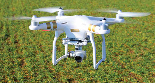
Drones can provide significant benefits for residents and business in rural areas: delivering medical supplies, collecting data on the status of crops, aiding in search and rescue efforts.

Unfortunately, these areas also tend to have very little in the way of communications infrastructure that unmanned aerial systems can leverage, according to James Grimsley, the president and CEO of autonomous systems developer Design Intelligence Inc. DII has been working as a consultant to the Choctaw Nation of Oklahoma on its drone programs.

There are two levels of infrastructure to consider with drones operating in rural areas: air traffic management and data management, said Grimsley, who also serves as associate vice president for research at the University of Oklahoma’s Norman Campus.

The technology developed to track commercial aircrafts wasn’t designed to accommodate large numbers of drones, so ground-based radar will be tested in Oklahoma. The required data exchange between operator and drone will likely be handled by “a little bit of everything,” including cellular networks and the expansion of groundbased fiber, Grimsley said.

As one of the selected participants of the Federal Aviation Administration’s Drone Integration Pilot Program, the Choctaw Nation and its 20 partners will be investigating how rural communities can best create the infrastructure to support integration of drones into the national airspace and advance extended visual line of sight and night operations. It will also be testing drones for agriculture, public safety and weather warning systems.

Among the Choctaw Nation’s partners are Airxos, which has a background in working on UAS traffic management project; Airmap, a provider of Low Altitude Authorization and Notification Capability software that facilitates drone flight planning and authorization; and Intel, which has experience with drone communications and integrating computer vision into unmanned systems.

One of the first tests will be on a 44,000-acre ranch owned by the tribe that doesn’t have a built-out road system. The the partners will evaluate drones’ ability to find lost cattle and deliver medical supplies beyond the operator’s line of sight. The tribe and its partners will also be conducting night flights to measure variables in crops that could affect yield.

Weather is another area of interest. Grimsley said the team wants to use the drones to get better data on weather to potentially help improve tornado warnings. The current system only gives residents about 12 minutes warning, which is “not a lot of time,” Grimsley said.

When the investigation is finished, the Choctaw Nation will demonstrate its work with extended visual line of sight capabilities and night flights.

“I have never seen momentum moving forward like we have with this,” Grimsley said. “The resources the FAA [has] devoted to it, the attention they’re putting to it, the cohesive kind of plan and kind of attitude within the government right now is very positive.”

This article originally appeared in the September 2018 issue of Security Today.

About the Author

Matthew Leonard is a reporter at GCN.com

Featured

  • Data Driven, Proactive Response

    As cities face rising demands for smarter policing and faster emergency response, Real Time Crime Centers (RTCCs) are emerging as essential hubs for data-driven public safety. In this interview, two experts with deep field experience — Ross Bourgeois of New Orleans and Dean Cunningham of Axis Communications — draw on decades of operational, leadership and technology expertise to share how RTCCs are transforming public safety through innovation, interagency collaboration and a relentless focus on community impact. Read Now

  • Integration Imagination: The Future of Connected Operations

    Security teams that collaborate cross-functionally and apply imagination and creativity to envision and design their ideal integrated ecosystem will have the biggest upside to corporate security and operational benefits. Read Now

  • Smarter Access Starts with Flexibility

    Today’s workplaces are undergoing a rapid evolution, driven by hybrid work models, emerging smart technologies, and flexible work schedules. To keep pace with growing workplace demands, buildings are becoming more dynamic – capable of adapting to how people move, work, and interact in real-time. Read Now

  • Trends Keeping an Eye on Business Decisions

    Today, AI continues to transform the way data is used to make important business decisions. AI and the cloud together are redefining how video surveillance systems are being used to simulate human intelligence by combining data analysis, prediction, and process automation with minimal human intervention. Many organizations are upgrading their surveillance systems to reap the benefits of technologies like AI and cloud applications. Read Now

  • The Future is Happening Outside the Cloud

    For years, the cloud has captivated the physical security industry. And for good reason. Remote access, elastic scalability and simplified maintenance reshaped how we think about deploying and managing systems. But as the number of cameras grows and resolutions push from HD to 4K and beyond, the cloud’s limits are becoming unavoidable. Bandwidth bottlenecks. Latency lags. Rising storage costs. These are not abstract concerns. Read Now

New Products

  • ResponderLink

    ResponderLink

    Shooter Detection Systems (SDS), an Alarm.com company and a global leader in gunshot detection solutions, has introduced ResponderLink, a groundbreaking new 911 notification service for gunshot events. ResponderLink completes the circle from detection to 911 notification to first responder awareness, giving law enforcement enhanced situational intelligence they urgently need to save lives. Integrating SDS’s proven gunshot detection system with Noonlight’s SendPolice platform, ResponderLink is the first solution to automatically deliver real-time gunshot detection data to 911 call centers and first responders. When shots are detected, the 911 dispatching center, also known as the Public Safety Answering Point or PSAP, is contacted based on the gunfire location, enabling faster initiation of life-saving emergency protocols.

  • Camden CV-7600 High Security Card Readers

    Camden CV-7600 High Security Card Readers

    Camden Door Controls has relaunched its CV-7600 card readers in response to growing market demand for a more secure alternative to standard proximity credentials that can be easily cloned. CV-7600 readers support MIFARE DESFire EV1 & EV2 encryption technology credentials, making them virtually clone-proof and highly secure.

  • EasyGate SPT and SPD

    EasyGate SPT SPD

    Security solutions do not have to be ordinary, let alone unattractive. Having renewed their best-selling speed gates, Cominfo has once again demonstrated their Art of Security philosophy in practice — and confirmed their position as an industry-leading manufacturers of premium speed gates and turnstiles.