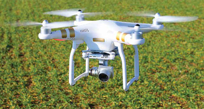
Expanding Rural Infrastructure for Drones
Leveraging drones despite the lack of communications infrastructure
- By Matthew Leonard
- Sep 01, 2018
Drones can provide significant benefits for residents
and business in rural areas: delivering medical supplies,
collecting data on the status of crops, aiding in
search and rescue efforts.
Unfortunately, these areas also tend to have very
little in the way of communications infrastructure that unmanned aerial
systems can leverage, according to James Grimsley, the president and
CEO of autonomous systems developer Design Intelligence Inc. DII
has been working as a consultant to the Choctaw Nation of Oklahoma
on its drone programs.
There are two levels of infrastructure to consider with drones operating
in rural areas: air traffic management and data management,
said Grimsley, who also serves as associate vice president for research
at the University of Oklahoma’s Norman Campus.
The technology developed to track commercial aircrafts wasn’t
designed to accommodate large numbers of drones, so ground-based
radar will be tested in Oklahoma. The required data exchange between
operator and drone will likely be handled by “a little bit of everything,”
including cellular networks and the expansion of groundbased
fiber, Grimsley said.
As one of the selected participants of the Federal Aviation Administration’s
Drone Integration Pilot Program, the Choctaw Nation
and its 20 partners will be investigating how rural communities can
best create the infrastructure to support integration of drones into the
national airspace and advance extended visual line of sight and night
operations. It will also be testing drones for agriculture, public safety
and weather warning systems.
Among the Choctaw Nation’s partners are Airxos, which has a
background in working on UAS traffic management project; Airmap,
a provider of Low Altitude Authorization and Notification Capability
software that facilitates drone flight planning and authorization;
and Intel, which has experience with drone communications and integrating
computer vision into unmanned systems.
One of the first tests will be on a 44,000-acre ranch owned by the
tribe that doesn’t have a built-out road system. The the partners will
evaluate drones’ ability to find lost cattle and deliver medical supplies
beyond the operator’s line of sight. The tribe and its partners will also
be conducting night flights to measure variables in crops that could
affect yield.
Weather is another area of interest. Grimsley said the team wants
to use the drones to get better data on weather to potentially help improve
tornado warnings. The current system only gives residents about
12 minutes warning, which is “not a lot of time,” Grimsley said.
When the investigation is finished, the Choctaw Nation will demonstrate
its work with extended visual line of sight capabilities and
night flights.
“I have never seen momentum moving forward
like we have with this,” Grimsley said. “The
resources the FAA [has] devoted to it, the attention
they’re putting to it, the cohesive kind of
plan and kind of attitude within the government
right now is very positive.”
This article originally appeared in the September 2018 issue of Security Today.
About the Author
Matthew Leonard is a reporter at GCN.com