Tackling Traffic Congestion
Three technology solutions and how they drive other improvement in city living
- By Kevin Taylor
- Sep 19, 2022
One of the biggest drawbacks to living and working in modern cities is traffic congestion. It frustrates motorists. It increases the probability of accidents. It can slow response time for emergency services. And, it lowers air quality.
On its face, congestion is a nuisance and a time-drain. It is also a safety issue. Many traffic accidents occur in congested areas. If a city can reduce congestion, it can reduce transit-related accidents resulting in severe injuries and fatalities and come closer to achieving its Vision Zero goal.*
There are, however, other benefits to reducing congestion that have to do with emergency response services. If a city can reduce the number of accidents occurring on its roads, it naturally follows that they can also reduce the number of emergency dispatches to those types of events. This frees up ambulances, firefighters and police to commit their limited resources to other non-traffic-related emergencies throughout the city.
An additional benefit has to do with environmental impact. Vehicles rank as one of the two largest sources of urban greenhouse gas emissions, the other being power generation and distribution for heating and cooling systems in buildings. Reducing congestion reduces the length of time vehicles stay on the road. This, in turn, reduces fuel consumption and emissions, which improves air quality and brings the city a step closer to carbon neutrality.
Three Traffic Challenges: Three Architected Solutions
There are many ways to leverage technology to minimize traffic congestion. Three of the most popular approaches are traffic signal management, parking space monitoring and safe roadway design.
Traffic signal management technology focuses on dynamic change to use traffic data in real time to change the phase and timing of traffic lights to reduce motorist wait times. Parking space monitoring technology focuses on tracking available spots roadside, in surface lots and in garages, and then communicating that information to motorists in real time so they do not keep circling the block, wasting gas, and slowing traffic as they search for an open spot.
Safe roadway design is possible through automated collection of data that informs city planners and traffic engineers how people, products and vehicles move through the public right-of-way, and by detecting “near-miss” events.
Improving Intersection Flow Through
Historically, transportation departments programmed their traffic signals based on studies conducted by third-party consulting firms. These studies are expensive and time-consuming to produce, leaving most signal-controlled intersections to go several years between updates. Unfortunately, operating signals on pre-programmed fixed intervals that reflected outdated traffic patterns often finds motorists waiting in long queues at an intersection even when there are no cars coming the other way.
Shifting to dynamic signal control based on real-time data helps alleviate this issue by using sensors and analytics to detect and quantitatively measure the number of vehicles at the intersection and dynamically changing the signal sequence to create more free flowing traffic. For example, the signal controller could skip a green interval for a direction with no traffic or extend a green interval for a direction with a long queue. Networking these intelligent signal controllers along city corridors enables them to work together to ensure that signal changes at one intersection will not have a negative impact at other intersections.
Another aspect of dynamic signal timing is emergency vehicle pre-emption. Depending on system configuration, a traffic-management-center operator can temporarily override the signal controllers to create a faster route for emergency responders to travel. In some cases, the ambulance, fire truck or police car transmits the command to a roadside communications gateway, which then sends a command to the intersection signal controller to greenlight the corridor for them.
Directing People to Available Parking
Motorists traveling in congested urban areas often spend a lot of their trip time trying to find available parking. However, every time they circle the block, suddenly change lanes, slam on the breaks or make an illegal U-turn when they spy a spot, the likelihood of an accident occurring increases.
Parking space monitoring solutions already exist. For instance, many parking garages currently use video cameras and sensors to identify occupied and unoccupied parking spots and visualize that data via electronic signage and lane lights, making it easy for motorists to find open spots. Privately-operated parking facilities currently offer apps for motorists to reserve and pay for a parking spot before they leave home.
Looking forward, the goal is to achieve deep integrations between these parking occupancy-sensing technologies and the most popular mobile navigation apps used by motorists. With such an integration, real-time parking data is visible to motorists via the navigation app as they approach their destination – including the precise location of available parking in the immediate area, as well as their fees. This would require collaboration between the public and private sector to finance, develop and operate such a service, but the investment could be a win-win for everyone. It would reduce motorist anxiety about finding a parking space, help parking operators increase their occupancy, and improve safety and air quality by getting motorists off congested streets more efficiently.
Revamping High-risk Roadways
Transportation studies show that the greater number of near misses at a given intersection, the more likely a collision will eventually happen. That is why cities are investing in technology to help them identify those places, understand what might be causing motorists to behave unexpectedly, and then strategize on ways to re-engineer those locations for safer navigation.
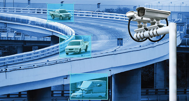
Near-miss detection systems often combine video and analytics to alert when vehicles or pedestrians take a non-engineered path through an intersection. This could include actions like a motorist abruptly crossing multiple lanes to make a left or right turn, driving straight ahead from a turn-only lane, or holding up a line of traffic while they try to merge into another lane to avoid turning.
Cameras and analytics can bookmark those events for the transportation department to review. This may lead to improved placement of signage, more prominent lane striping, elimination of the encroachment to the right-of-way, or any number of other changes to make navigation less ambiguous and confusing. In turn, this helps the city reduce vehicular accidents, injuries and fatalities.
By adding audio analytics, the system can detect acoustic anomalies like screeching tires, or excessive revving of motors – often an indication of street racing. Associated video and sound will alert the proper authorities, and emergency responders sent to the scene.
Investing in Technology that Delivers Multi-level Benefits
Many technology companies offering products and solutions to meet the challenges of modern cities. Before an integrator presents their value proposition to a municipal agency, they should consider the secondary and tertiary benefits other agencies might derive from sharing in that investment. Whether it’s less traffic congestion, more efficient use of emergency services, improved resilience and sustainability, reduced environmental impact, or some other advantage; if you show other potential stakeholders compelling reasons to endorse the solution, you are more likely to get funding for - and adoption of - your proposal.
This article originally appeared in the September / October 2022 issue of Security Today.