Drone Detection Tech Integrates With Public Safety Software
A new technological alliance unifies airspace monitoring and ground-level security data to accelerate law enforcement responses to airborne threats.
- By Jesse Jacobs
- Jun 01, 2026
AirSight and Flock Safety have launched a new data integration that links airspace monitoring directly with ground-level law enforcement software to accelerate responses to airborne security threats.
A new technological alliance aims to close the gap between detecting unauthorized drones and apprehending their operators on the ground by unifying airspace and roadway data into a single operational viewpoint.
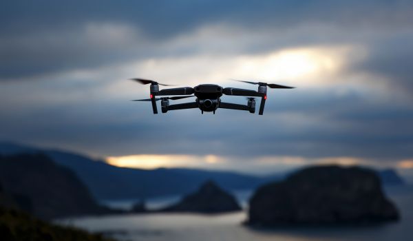
AirSight, developer of the AirGuard airspace security platform, has integrated its real-time drone tracking data directly into FlockOS, a public-safety operating system utilized by numerous law enforcement agencies. The combined system automatically funnels drone positions, altitudes and operator locations into the same interface agencies use for license plate readers and video feeds.
The technology integration follows a recent incident at a correctional facility in Grant Parish, Louisiana, where authorities intercepted a drone attempting to smuggle methamphetamine, marijuana and cell phones hidden inside plastic crow decoys. AirSight’s detection platform located the drone and the operator's broadcast coordinates, allowing the Grant Parish Sheriff’s Office to track the suspects to a vehicle and make arrests.
Historically, drone incidents at critical infrastructure or correctional facilities ended with the recovery of contraband at the perimeter, while the pilots escaped undetected. The new integration addresses this vulnerability through three primary capabilities:
- Unified Mapping: AirGuard data appears as a live asset on the existing FlockOS map, removing the need for operators to toggle between separate monitors during an active incident.
- Pilot-to-Plate Correlation: Security analysts can cross-reference the pinpointed location of a drone pilot with automated license plate reader data from the surrounding area to identify suspect getaway vehicles.
- Automated DFR Triggers: A forthcoming feature will allow unauthorized drone detections to automatically launch a Drone as First Responder (DFR) unit to provide immediate aerial surveillance of the launch site.
Security experts note that while drone detection technology has matured rapidly, the workflow required to coordinate a ground response has lagged. Linking airspace intelligence with street-level data allows correctional facilities, critical infrastructure sites and large event venues to coordinate responses within minutes rather than hours.
According to company officials, the integration removes the friction of switching between disparate systems during fast-moving incidents, providing officers with actionable coordinates and a vehicle-level chain of evidence within their established daily workflows.