Expanding Rural Infrastructure for Drones

Expanding Rural Infrastructure for Drones

Leveraging drones despite the lack of communications infrastructure

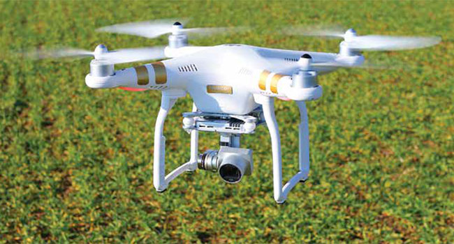
Drones can provide significant benefits for residents and business in rural areas: delivering medical supplies, collecting data on the status of crops, aiding in search and rescue efforts.

Unfortunately, these areas also tend to have very little in the way of communications infrastructure that unmanned aerial systems can leverage, according to James Grimsley, the president and CEO of autonomous systems developer Design Intelligence Inc. DII has been working as a consultant to the Choctaw Nation of Oklahoma on its drone programs.

There are two levels of infrastructure to consider with drones operating in rural areas: air traffic management and data management, said Grimsley, who also serves as associate vice president for research at the University of Oklahoma’s Norman Campus.

The technology developed to track commercial aircrafts wasn’t designed to accommodate large numbers of drones, so ground-based radar will be tested in Oklahoma. The required data exchange between operator and drone will likely be handled by “a little bit of everything,” including cellular networks and the expansion of groundbased fiber, Grimsley said.

As one of the selected participants of the Federal Aviation Administration’s Drone Integration Pilot Program, the Choctaw Nation and its 20 partners will be investigating how rural communities can best create the infrastructure to support integration of drones into the national airspace and advance extended visual line of sight and night operations. It will also be testing drones for agriculture, public safety and weather warning systems.

Among the Choctaw Nation’s partners are Airxos, which has a background in working on UAS traffic management project; Airmap, a provider of Low Altitude Authorization and Notification Capability software that facilitates drone flight planning and authorization; and Intel, which has experience with drone communications and integrating computer vision into unmanned systems.

One of the first tests will be on a 44,000-acre ranch owned by the tribe that doesn’t have a built-out road system. The the partners will evaluate drones’ ability to find lost cattle and deliver medical supplies beyond the operator’s line of sight. The tribe and its partners will also be conducting night flights to measure variables in crops that could affect yield.

Weather is another area of interest. Grimsley said the team wants to use the drones to get better data on weather to potentially help improve tornado warnings. The current system only gives residents about 12 minutes warning, which is “not a lot of time,” Grimsley said.

When the investigation is finished, the Choctaw Nation will demonstrate its work with extended visual line of sight capabilities and night flights.

“I have never seen momentum moving forward like we have with this,” Grimsley said. “The resources the FAA [has] devoted to it, the attention they’re putting to it, the cohesive kind of plan and kind of attitude within the government right now is very positive.”

This article originally appeared in the September 2018 issue of Security Today.

About the Author

Matthew Leonard is a reporter at GCN.com

Featured

  • Report: 47 Percent of Security Service Providers Are Not Yet Using AI or Automation Tools

    Trackforce, a provider of security workforce management platforms, today announced the launch of its 2025 Physical Security Operations Benchmark Report, an industry-first study that benchmarks both private security service providers and corporate security teams side by side. Based on a survey of over 300 security professionals across the globe, the report provides a comprehensive look at the state of physical security operations. Read Now

    • Guard Services
  • Identity Governance at the Crossroads of Complexity and Scale

    Modern enterprises are grappling with an increasing number of identities, both human and machine, across an ever-growing number of systems. They must also deal with increased operational demands, including faster onboarding, more scalable models, and tighter security enforcement. Navigating these ever-growing challenges with speed and accuracy requires a new approach to identity governance that is built for the future enterprise. Read Now

  • Eagle Eye Networks Launches AI Camera Gun Detection

    Eagle Eye Networks, a provider of cloud video surveillance, recently introduced Eagle Eye Gun Detection, a new layer of protection for schools and businesses that works with existing security cameras and infrastructure. Eagle Eye Networks is the first to build gun detection into its platform. Read Now

  • Report: AI is Supercharging Old-School Cybercriminal Tactics

    AI isn’t just transforming how we work. It’s reshaping how cybercriminals attack, with threat actors exploiting AI to mass produce malicious code loaders, steal browser credentials and accelerate cloud attacks, according to a new report from Elastic. Read Now

  • Pragmatism, Productivity, and the Push for Accountability in 2025-2026

    Every year, the security industry debates whether artificial intelligence is a disruption, an enabler, or a distraction. By 2025, that conversation matured, where AI became a working dimension in physical identity and access management (PIAM) programs. Observations from 2025 highlight this turning point in AI’s role in access control and define how security leaders are being distinguished based on how they apply it. Read Now

New Products

  • FEP GameChanger

    FEP GameChanger

    Paige Datacom Solutions Introduces Important and Innovative Cabling Products GameChanger Cable, a proven and patented solution that significantly exceeds the reach of traditional category cable will now have a FEP/FEP construction.

  • AC Nio

    AC Nio

    Aiphone, a leading international manufacturer of intercom, access control, and emergency communication products, has introduced the AC Nio, its access control management software, an important addition to its new line of access control solutions.

  • A8V MIND

    A8V MIND

    Hexagon’s Geosystems presents a portable version of its Accur8vision detection system. A rugged all-in-one solution, the A8V MIND (Mobile Intrusion Detection) is designed to provide flexible protection of critical outdoor infrastructure and objects. Hexagon’s Accur8vision is a volumetric detection system that employs LiDAR technology to safeguard entire areas. Whenever it detects movement in a specified zone, it automatically differentiates a threat from a nonthreat, and immediately notifies security staff if necessary. Person detection is carried out within a radius of 80 meters from this device. Connected remotely via a portable computer device, it enables remote surveillance and does not depend on security staff patrolling the area.